Prof. Dr. Volker Coors

Prorektor Forschung und Digitalisierung
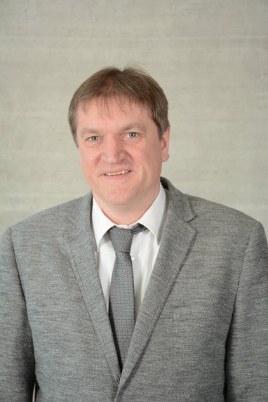
Prof. Dr. Volker Coors
Lehrgebiet/e:

Geoinformatik

Studienbereiche:
Informatik
Vermessung
Telefon:
+49 711 8926 2663
Büro:
1/121
Sprechzeiten:
Montags Mittwochs 13 - 14 Uhr
per Web-Konferenz
https://hft-stuttgart-de.zoom.us/j/61004982620
Kompetenzzentrum:
  • Geodäsie und Geoinformatik

Vita

  • seit 1.3.2023

    Prorektor Forschung und Digitalisierung

  • 2019 - 2023

    Wissenschaftlicher Direktor des Instituts für Angewandte Forschung

  • 2017 - 2023

    Sprecher Forschungsschwerpunkt "Smarte Technologien, Prozesse und Methoden"

  • seit 2016

    Leiter Steinbeis Transferzentrum Technische Beratung an der Hochschule für Technik Stuttgart

  • 2006 - 2017

    Studiendekan Bachelor-Studiengang Informationslogistik

  • seit 2002

    Professor der Informatik und Geoinformatik an der HFT Stuttgart, Fakultät Vermessung, Informatik und Mathematik

  • 2003

    Promotion (Dr.-Ing.) am Fachbereich Informatik, Technische Universität Darmstadt, Gesamturteil „Sehr gut“

  • 2001

    DAAD-Stipendium für einen Forschungsaufenthalt am Georgia Institute of Technology, Atlanta, USA

  • 1997-2002

    Wissenschaftlicher Mitarbeiter bei der Fraunhofer Gesellschaft, Institut Graphische Datenverarbeitung, Darmstadt. Seit 2001 Leitung der Projektbereiche 3D-GIS und Location Based Services, seit 2002 stellvertretender Abteilungsleiter

  • 1997

    Studium der Informatik (Diplom) mit Nebenfach Bauingenieurwesen an der Technischen Universität Darmstadt, Gesamturteil "Mit Auszeichnung bestanden".

Forschung

3DPS-RTGIS

Einfache dienstbasierte Nutzung von 3D-Daten

Zum Projekt

3ProzentPlus

Energieeffiziente Sanierungsfahrpläne für kommunale Quartiere

Zum Projekt

CircularGreenSimCity

Ganzheitlich-ressourceneffiziente Betrachtung von Stadtquartieren

Zum Projekt

CityDoctor 2

System zur automatisierten Reparatur von Stadtmodellen

Zum Projekt
Grafische Darstellung Architekturmodell

Digitaler Zwilling

Wiss. Begleitung: Digitaler Zwilling Mobilität und Umwelt

Zum Projekt

EnSys-LE

Lokale Energiemärkte als Bindeglied der Energiewende

Zum Projekt
Logo des Projekts

EnVisaGe Plus

Überblick

Zum Projekt
Grafik Stadt-Landausgleich zwischen einer ländlichen „Plus-Energiezelle“ und einem Industriegebiet

FORTH-BW

Entwicklung und Implementierung eines bedarfsgerechten Forschungsdatenmanagements an HAW in Baden-Württemberg – Teilvorhaben 4: Schwerpunktthema: IT-Unterstützung

Zum Projekt
FORTH-bw Logo

iCity 2: DiaOpt4iCity

Diagnostik zur Kategorisierung und Optimierung von Gebäudestrukturen und Wärmenetzen

Zum Projekt

iCity 2: ICT4iCity

Informationsplattform und IKT

Zum Projekt

iCity 2: IQG4iCity

Gebäude, Quartiere und Infrastruktur

Zum Projekt
Übergeordnete Ziele und Ansätze des Impulsprojektes "Gebäude, Quartiere und Infrastruktur"

iCity2: Streetmoves4iCity

Streetmoves für die Intelligente Stadt

Zum Projekt

iCity 2: UDigit4iCity

Urbane Digitale Zwillinge (Urban Digital Twins) für die iCity

Zum Projekt
Logo Projekt UDigiT4iCity

INSPIRER

Partizipation in Stadtplanungsprozessen In virtuellen und realen Räumen

Zum Projekt

IN-SOURCE

Analyse und Modellierung des Lebensmittel-Wasser-Energie-Nexus anhand von drei Modellregionen

Zum Projekt
Grafische Abbildung des Projektschemas

M4_LAB Innovative Hochschule

HFT-lnnovationslabor für die Metropolregion 4.0

Zum Projekt
Meeting eines Teams

SensAR

Sensorische Daten und Augmented Reality

Zum Projekt
Person vor Hinweisschild

SIMSTADT

Energiesimulation von Stadtquartieren

Zum Projekt
Logo SimStadt

Veröffentlichungen

  • 2020

    Coors, Volker; Betz, Matthias; Duminil, Eric (2020): A Concept of Quality Management of 3D City Models Supporting Application-Specific Requirements. In Journal of Photogrammetry, Remote Sensing and Geoinformation Science 88 (1), pp. 3–14. DOI: 10.1007/s41064-020-00094-0 .

  • 2020

    Wate, P.; Iglesias, M.; Coors, V.; Robinson, D. (2020): Framework for emulation and uncertainty quantification of a stochastic building performance simulator. In Applied Energy 258 (88), pp. 3–14. DOI: 10.1016/j.apenergy.2019.113759 .

  • 2020

    Koukofikis, A.; Coors, V. (2020): Visual Analytics Web Platform for Detecting High Wind Energy Potential in Urban Environments by employing OGC standards. In Int. Arch. Photogramm. Remote Sens. Spatial Inf. Sci. XLIV-4/W1-2020, pp. 71–74. DOI: 10.5194/isprs-archives-XLIV-4-W1-2020-71-2020 .

  • 2020

    Coors, V. (Ed.) (2020): OGC 3D-IoT Platform for Smart Cities Engineering Report (OGC 19-073r1). Available online at http://docs.opengeospatial.org/per/19-073r1.html.

  • 2020

    Würstle, Patrick; Santhanavanich, Thunyathep; Padsala, Rushikesh; Coors, Volker (2020): The Conception of an Urban Energy Dashboard using 3D City Models. In : Proceedings of the Eleventh ACM International Conference on Future Energy Systems. e-Energy '20: The Eleventh ACM International Conference on Future Energy Systems. Virtual Event Australia, June 22 - 26, 2020. New York, NY, USA: ACM, pp. 523–527.

  • 2020

    Santhanavanich, T.; Kim, C.; Coors, V. (2020): INTEGRATION OF HETEROGENEOUS CORONAVIRUS DISEASE COVID-19 DATA SOURCES USING OGC SENSORTHINGS API. In ISPRS Ann. Photogramm. Remote Sens. Spatial Inf. Sci. VI-4/W2-2020, pp. 135–141. DOI: 10.5194/isprs-annals-VI-4-W2-2020-135-2020 .

  • 2020

    Schneider, S.; Santhanavanich, T.; Koukofikis, A.; Coors, V. (2020): EXPLORING SCHEMES FOR VISUALIZING URBAN WIND FIELDS BASED ON CFD SIMULATIONS BY EMPLOYING OGC STANDARDS. In ISPRS Ann. Photogramm. Remote Sens. Spatial Inf. Sci. VI-4/W2-2020, pp. 157–163. DOI: 10.5194/isprs-annals-VI-4-W2-2020-157-2020 .

  • 2020

    Bao, Keyu; Padsala, Rushikesh; Coors, Volker; Thrän, Daniela; Schröter, Bastian (2020): A Method for Assessing Regional Bioenergy Potentials Based on GIS Data and a Dynamic Yield Simulation Model. In Energies 13 (6488). DOI: 10.3390/en13246488 .

  • 2020

    Bao, K.; Padsala, R.; Coors, V.; Thrän, D.; Schröter, B. (2020): GIS-Based Assessment of Regional Biomass Potentials at the Example of Two Counties in Germany. Conference: 28th European Biomass Conference and Exhibition.

  • 2020

    Deininger, Martina E.; Grün, Maximilian von der; Piepereit, Raul; Schneider, Sven; Santhanavanich, Thunyathep; Coors, Volker; Voß, Ursula (2020): A Continuous, Semi-Automated Workflow: From 3D City Models with Geometric Optimization and CFD Simulations to Visualization of Wind in an Urban Environment. In IJGI 9 (11), p. 657. DOI: 10.3390/ijgi9110657 .

  • 2020

    Coors, V. (Ed.) (2020): OGC 3D-IoT Platform for Smart Cities Engineering Report (OGC 19-073r1). Available online at http://docs.opengeospatial.org/per/19-073r1.html.

  • 2020

    Vögele, Monique; Santhanavanich, Thunyathep; Würstle, Patrick; Graf, Gerald; Coors, Volker (2020): Smart Villages - Vernetzung von 3D-Geoinformation und umweltrelevanten Sensordaten im ländlichen Raum (gis.Science 2/2020), pp. 47–58.

  • 2020

    Harbola, S.; Coors, V. (2020): SEASONALITY DEDUCTION PLATFORM: FOR PM10, PM2.5, NO, NO2 AND O3 IN RELATIONSHIP WITH WIND SPEED AND HUMIDITY. In ISPRS Ann. Photogramm. Remote Sens. Spatial Inf. Sci. VI-4/W2-2020, pp. 71–78. DOI: 10.5194/isprs-annals-VI-4-W2-2020-71-2020 .

  • 2020

    Schneider, S.; Dastageeri, H.; Rodrigues, P.; Coors, V. (2020): “I KNOW HOW YOU FEEL” – PREDICTING EMOTIONS FROM SENSORS FOR ASSISTED PEDELEC EXPERIENCES IN SMART CITIES. In ISPRS Ann. Photogramm. Remote Sens. Spatial Inf. Sci. VI-4/W2-2020, pp. 149–156. DOI: 10.5194/isprs-annals-VI-4-W2-2020-149-2020 .

  • 2020

    Padsala, Rushikesh; Fink, Theresa; Peters-Anders, Jan; Gebetsroither-Geringer, Ernst; Coors, Volker (Eds.) (2020): From Urban Design to Energy Simulation – a Data Conversion Process Bridging the Gap Between Two Domains. REAL CORP 2020, 15-18 September 2020.

  • 2020

    Sini, S. K.; Sihombing, R.; Kabiro, P. M.; Santhanavanich, T.; Coors, V. (2020): THE USE OF 3D GEOVISUALIZATION AND CROWDSOURCING FOR OPTIMIZING ENERGY SIMULATION. In ISPRS Ann. Photogramm. Remote Sens. Spatial Inf. Sci. VI-4/W2-2020, pp. 165–172. DOI: 10.5194/isprs-annals-VI-4-W2-2020-165-2020 .

  • 2021

    Santhanavanich, T.; Coors, V. CityThings: An integration of the dynamic sensor data to the3D city model. Environment and Planning B: Urban Analytics and City Science2021, 16 pp , https://doi.org/10.1177/2399808320983000

  • 2021

    Steingrube, A.; Bao, K.; Wieland, S.; Lalama, A.; Kabiro, P.M.M.; Coors, V.; Schröter, B. A Method for Optimizing and Spatially Distributing Heating Systems by Coupling an Urban Energy Simulation Platform and an Energy System Model. Resources2021, 10, 52. 19 pp https://doi.org/10.3390/resources10050052

  • 2021

    Goy, S.; Coors, V.; Finn, D. Grouping techniques for building stock analysis: A comparative case study. Energy and Buildings 2021, 26 pp. doi:https://doi.org/10.1016/j.enbuild.2021.110754

  • 2021

    Bao, K.; Padsala, R.; Coors, V.; Thrän, D.; Schröter, B. A GIS-Based Simulation Method for Regional Food Potential and Demand. Land 2021, 10, 880. https://doi.org/10.3390/land10080880

  • 2021

    Koukofikis, A.; Coors, V. A Visual Analytics Web Platform for Detecting High Wind Energy Potential in Urban Environments by Employing OGC Standards. ISPRS Int. J. Geo-Inf. 2021, 10, 707. 23 pp, https://doi.org/10.3390/ijgi10100707

  • 2022

    Theile, P.; Kesnar, C., Czock, B.; Moritz, M.; Novirdoust, A.; Coors, V.; Wagner, J.; Schröter, B.: There’s no place like home – The impact of residential heterogeneity on bottom-up energy system modeling,Energy and Buildings, Vol 254, 2022, 111591, 14 pp, ISSN 0378-7788, https://doi.org/10.1016/j.enbuild.2021.111591.

  • 2022

    Harbola, S., Coors, V. Deep Learning Model for Wind Forecasting: Classification Analyses for Temporal Meteorological Data. PFG 90, 211–225 (2022). https://doi.org/10.1007/s41064-021-00185-6

  • 2022

    Würstle, Patrick; Padsala, Rushikesh; Santhanavanich, Thunyathep; Coors, Volker (2022): VIABILITY TESTING OF GAME ENGINE USAGE FOR VISUALIZATION OF GEOSPATIAL STANDARDS,  ISPRS Ann. Photogramm. Remote Sens. Spatial Inf. Sci., X-4/W2-2022. https://doi.org/10.5194/isprs-annals-X-4-W2-2022-281-2022

  • 2022

    Santhanavanich, Thunyathep; Padsala, Rushikesh; Würstle, Patrick; Coors, Volker (2022): The Spatial Data Infrastructure of an Urban Digital Twin in the Building Energy Domain Using OGC Standards,  ISPRS Ann. Photogramm. Remote Sens. Spatial Inf. Sci., https://doi.org/10.5194/isprs-annals-X-4-W2-2022-249-2022

  • 2022

    Santhanavanich, Thunyathep; Würstle, Patrick; Padsala, Rushikesh;  Coors, Volker (2022): DIGITAL 3D CITY MODELS TOWARDS URBAN DATA PLATFORM USING OGC 3D GEOVOLUMES API, Wissenschaftlich-Technische Jahrestagung der DGPF

  • 2022

    Dastageeri, H. , Schneider, S.  ,  Alfakhori, M., Coors, V. (2022), Hot Spots in Cities - Classifying Emotions During Physical Outdoor Activities in Urban Areas, GEOINFORMATION WEEK

  • 2022

    Coors, Volker; Pietruschka, Dirk; Zeitler, Berndt, iCity. Transformative Research for the Livable, Intelligent, and Sustainable City, 2022, Springer https://link.springer.com/book/10.1007/978-3-030-92096-8

  • 2022

    Harbola, Shubhi; Storz, Martin; Coors, Volker: Augmented Reality for Windy Cities: 3D Visualization of Future Wind Nature Analysis in City Planning, iCity. Transformative Research for the Livable, Intelligent, and Sustainable City: Coors, Volker; Pietruschka, Dirk; Zeitler, Berndt (2022) https://link.springer.com/book/10.1007/978-3-030-92096-8

  • 2022

    Martirano, G., Pignatelli, F., Vinci, F., Struck, C., Coors, V., Fitzky, M., Hernández Moral, G., Serna-González, V., Ramos-Díez, I. and Valmaseda, C., Comparative analysis of different methodologies and datasets for Energy Performance Labelling of buildings, EUR 30963 EN, Publications Office of the European Union, Luxembourg, 2022, ISBN 978-92-76-46608-6, doi:10.2760/746342, JRC124885. https://publications.jrc.ec.europa.eu/repository/handle/JRC124885

  • 2022

    Philipp Theile, Chris Kesnar, Berit Hanna Czock, Michael Moritz, Amir Ashour Novirdoust, Volker Coors, Johannes Wagner, Bastian Schröter, There’s no place like home – The impact of residential heterogeneity on bottom-up energy system modeling, Energy and Buildings, Volume 254, 2022, 111591, 14 pp, ISSN 0378-7788, https://doi.org/10.1016/j.enbuild.2021.111591.

  • 2022

    Alfakhori, M., Dastageeri, H., Schneider, S., and Coors, V.: OCCLUSION SCREENING USING 3D CITY MODELS AS A REFERENCE DATABASE FOR MOBILE AR-APPLICATIONS, ISPRS Ann. Photogramm. Remote Sens. Spatial Inf. Sci., X-4/W3-2022, 11–18, https://doi.org/10.5194/isprs-annals-X-4-W3-2022-11-2022, 2022.

  • 2022

    Alizadehashrafi, B., Coors, V. Bin Abdul Rahman, A. : Photorealistic versus Procedural Texturing of the 3D Buildings in Virtual Smart Cities, Earth Observation and Geomatics Engineering, 6(1), -. doi: 10.22059/eoge.2022.345196.1119 https://doi.org/10.22059/eoge.2022.345196.1119

Auszeichnungen und Preise

  • 2012

    Best Paper Award from Fraunhofer IGD "Intergrating Quality Management in to a 3D Geospatial Server"

  • 2007

    Digital Earth Award for the VEPs (Virtual Environmental Planning System) project

Wettbewerbe

  • 2000

    Prize winner ideas competition, virtual and augmented reality of the BMBF for the idea sketch GEIST

Weiteres

Volker Coors hat an der TU Darmstadt Informatik studiert und im Bereich Computergrafik promoviert. Seit 2002 ist er Professor für Informatik und Geo-Informatik an der HFT Stuttgart. Seine Forschungsschwerpunkte sind 3D-Geodateninfrastrukturen und die Visualisierung raumbezogener Daten. Von 2006-2017 war er Studiendekan des Studiengangs Informationslogistik, von 2019 - 2023 wissenschaftlicher Direktor des Instituts für angewandte Forschung. Seit März 2023 ist er Prorektor für Forschung und Digitalisierung der HFT Stuttgart.
Prof. Coors ist Mitglied der CityGML Standard Working Group (SWG) und Vorsitzender der 3D Portrayal SWG des Open Geospatial Consortiums (OGC). Er ist Gründungsmitglied der gemeinsamen Kommission „3D-Stadtmodelle“ der Deutschen Gesellschaft für Kartographie e.V. und der deutschen Gesellschaft für Photogrammetrie, Fernerkundung und Geoinformation e.V., Sprecher des Beirats des Runden Tisch GIS e.V. und Vize-Präsident der internationalen Urban Data Management Society.